Learning Center
Downloads


Tags
- 3D Digital Models 6
- 3d scanners 1
- AI in Construction 1
- AMG 1
- Artificial Intelligence 1
- As-Built 1
- Autocad 2
- Base and Rover 1
- Better meetings 1
- Big Data 2
- Big Data in Construction 3
- CAD 5
- CAD files 4
- Cad Services 1
- Changes in Construction 2
- Civil GPS systems 4
- Communication 2
- Conexpo 1
- Construction Data and Safety 3
- Construction Project Bidding 6
- Construction Takeoffs 6
- Construction control site networks 2
- Construction planning 1
- Construction projects 6
- Control Points 3
- Curbs 1
- DEM 1
- DSM 1
- DTM 4
- Dig safe 1
- Digital takeoffs 6
- Drone data 2
- Drones 2
- Earthwork drones 1
- Electronic Distance Measuring 1
- Ellipsoids 1
- Excavation Safety 1
- Excavation bidding process 3
- Excavation hybrid fleet 1
- GPS Machine Calibration 3
- GPS equipment software 4
- GPS/GNSS 8
- Geoids 2
- Heavy Equipment GPS 6
- Lidar 2
- Milling and Paving 1
- Milling and Paving Technologies 1
- Orthophotos 2
- Point Cloud 1
- RTK 3

ARTIFICIAL INTELLIGENCE’S USEFULNESS IN CONSTRUCTION
CONEXPO CON/AGG 2023 is coming up quick and if you’re headed to Las Vegas you’re sure to see many cool Artificial Intelligence options that can be useful in construction project management. From the bidding stage through completion, there are many reasons why you might want to consider adding AI into your workflows.

GRADING SURFACES: WHAT ARE THEY? HOW DO THEY IMPROVE CONSTRUCTION PROJECTS?
Are you wondering how a surface model will work with your heavy equipment? Although it can seem complex, it is simpler than you may think. Some machines already come equipped with the technology and others can be retrofitted with aftermarket technology systems. Either way, the most important thing to understand is that they run off GPS.

SAVE TIME AND RESOURCES WITH MASS DATA CAPTURE
Drones have proven to be an excellent tool for collecting mass data. Despite the obvious upfront cost for purchasing the drone, it is an inexpensive way to collect the data compared to conventional means. This method has many advantages, including speed, reliability, accuracy, cost-effectiveness, and more.
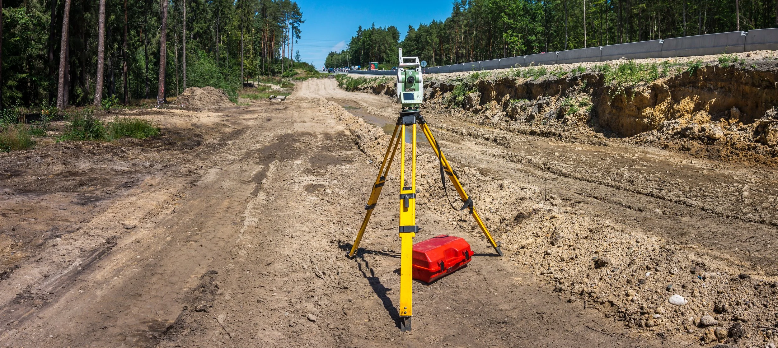
TOTAL STATIONS: HOW THEY IMPROVE DATA & ACCURACY ON JOB SITES
Have you ever been on a job site where the engineer only used a transit or theodolite to check grades? It takes them so long to set up, find their benchmark, measure the point, and calculate an elevation that you might as well send the crew home because it takes so long. Fortunately for you, most engineers these days use total stations or GPS rovers to check grades.

GOOD CONTROL SURVEYS LEAD TO BETTER CONTROL POINTS
The evolution of surveying over the years is very impressive. What used to take months to do years ago has been reduced to days or hours in modern-day surveying. There are many different methods used by surveyors. This blog will cover some of those methods.

SPOT ELEVATIONS: WHEN TO USE THEM INSTEAD OF CONTOUR LINES
Are you having trouble deciding when to use spot elevations versus contour lines to determine your breaklines? Well, don't worry because you're not alone. We are often confronted with that question and are here to help you figure it out.

HOW TO MEASURE THE ROI OF CIM
By bringing together virtual models, data analytics, systems, people, and improved workflows through CIM you will gain efficiencies in every phase. Stakeholders will be able to easily access and rely on accurate and timely information which will enable them to do their jobs better. Your projects will not run behind schedule as often and your overall costs will decrease.

PROJECT TURNAROUND: PROBLEMS THAT AFFECT SPEED AND HOW TO AVOID THEM
A question we are frequently asked by our clients and prospective clients is “What is the turnaround time for this project?”. Generally speaking, we typically run on average with a two-week turnaround time but situations sometimes impact that timeline which means it could take longer. Let’s go over some problems that impact the speed of model building.
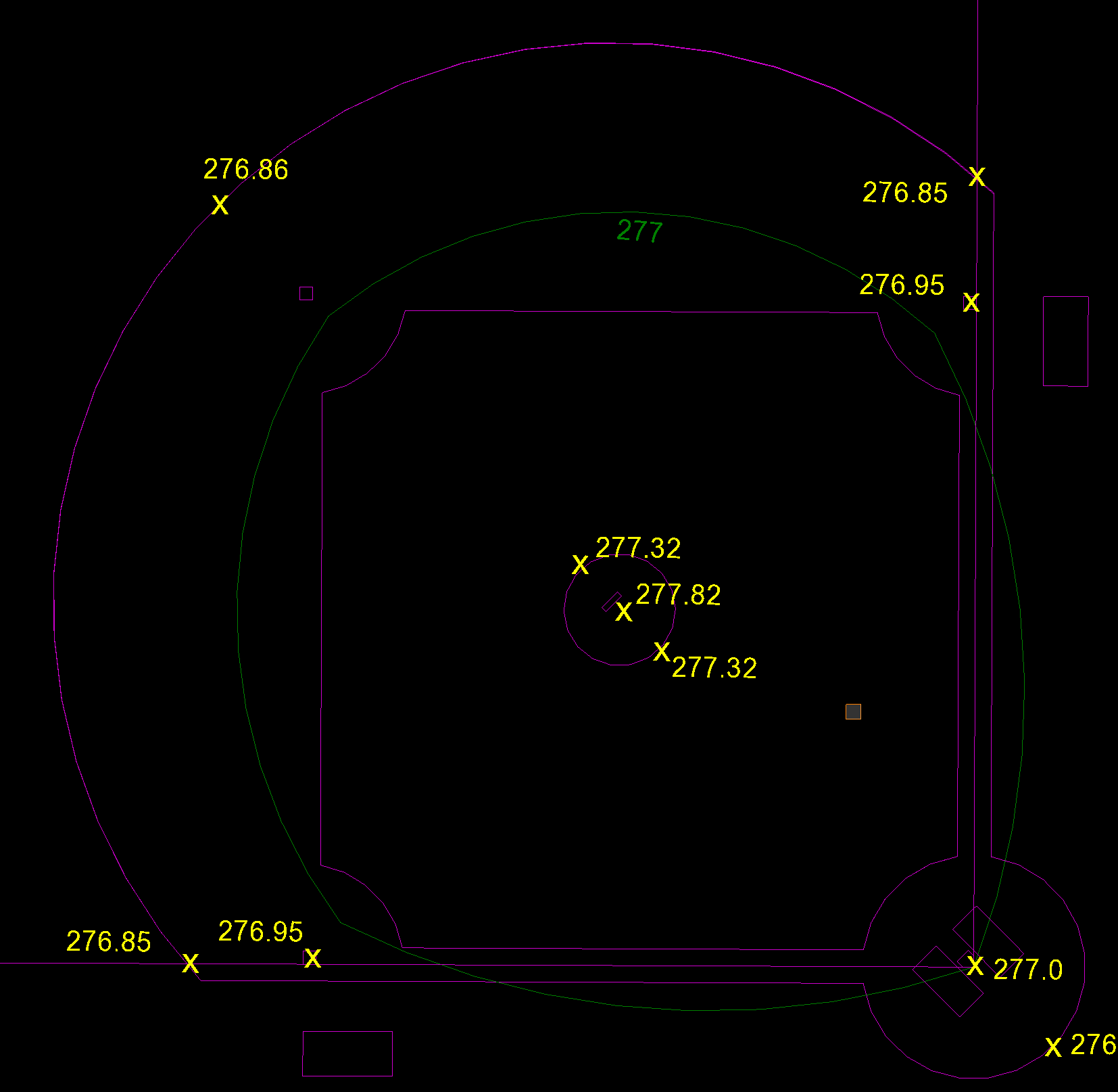
BREAKLINES: WHAT ARE THEY AND WHY ARE THEY IMPORTANT IN SURFACE MODELS
Breaklines are essential for creating a precise 3D surface model. Breaklines connect data representing specific features on a surface, such as the centerline of a road, a ridgeline, or a ditch's flowline. Whether to use spot elevations or contour lines to determine your breaklines is not always clear. Here, we help shed some light on the differences between contour lines and spot elevations and provide guidance on when to use which one.
Videos

Consideration When Buying a Drone

What Happens When You Start Working with ECI

How ECI Gives Your In-house GPS a Boost

How Much Does A Road Model Cost?