Learning Center
Downloads


Tags
- 3D Digital Models 7
- 3d scanners 1
- AI in Construction 1
- AMG 1
- Artificial Intelligence 1
- As-Built 1
- Autocad 2
- Base and Rover 1
- Better meetings 1
- Big Data 2
- Big Data in Construction 3
- CAD 5
- CAD files 4
- Cad Services 1
- Changes in Construction 2
- Civil GPS systems 5
- Communication 2
- Conexpo 1
- Construction Data and Safety 4
- Construction Project Bidding 6
- Construction Takeoffs 6
- Construction control site networks 2
- Construction planning 2
- Construction projects 6
- Control Points 3
- Curbs 1
- DEM 1
- DSM 1
- DTM 4
- Dig safe 2
- Digital takeoffs 6
- Drone data 2
- Drones 2
- Earthwork drones 1
- Electronic Distance Measuring 1
- Ellipsoids 1
- Excavation Safety 2
- Excavation bidding process 3
- Excavation hybrid fleet 1
- GPS Machine Calibration 3
- GPS equipment software 4
- GPS/GNSS 8
- Geoids 2
- Heavy Equipment GPS 6
- Lidar 2
- Milling and Paving 1
- Milling and Paving Technologies 1
- Orthophotos 2
- Point Cloud 1
- RTK 3

WHY GPS PRECISION IS THE MISSING TOOL IN YOUR LANDSCAPING WORKFLOW
Don’t be afraid to tap into the unknown when leveraging technology for your construction bids & projects. Technology is constantly evolving and enhancing the construction industry. A growing number of site contractors and landscapers have been using GPS machine control to improve the competitive nature that exists in this industry. Pursuing the endeavor of implementing GPS equipment can be daunting, especially when there is a lack of awareness surrounding the topic. Read further to learn more about how GPS equipment can help contractors and landscapers achieve success!

UNDERGROUND UTILITIES DETECTION: HOW GPS CAN MAKE A DIG SITE SAFER
One can never be too careful when it comes to underground utilities detection and digging. According to Common Ground Alliance (CGA), which represents a body of industry stakeholders that advocate for the 811 service, U.S. damages cost $30 billion every year! Contributing to the vast expense of damages are: failure to notify, excavating issues, and locating issues.

TOPCON & TRIMBLE COMPATIBILITY: IS A HYBRID FLEET VIABLE?
Companies have been using GPS technology on their construction equipment for a very long time. In most cases, companies stick with one manufacturer, but the brands used on their fleet vary for others. Is having a hybrid fleet viable? We say - Yes.

GOOD CONTROL SURVEYS LEAD TO BETTER CONTROL POINTS
The evolution of surveying over the years is very impressive. What used to take months to do years ago has been reduced to days or hours in modern-day surveying. There are many different methods used by surveyors. This blog will cover some of those methods.
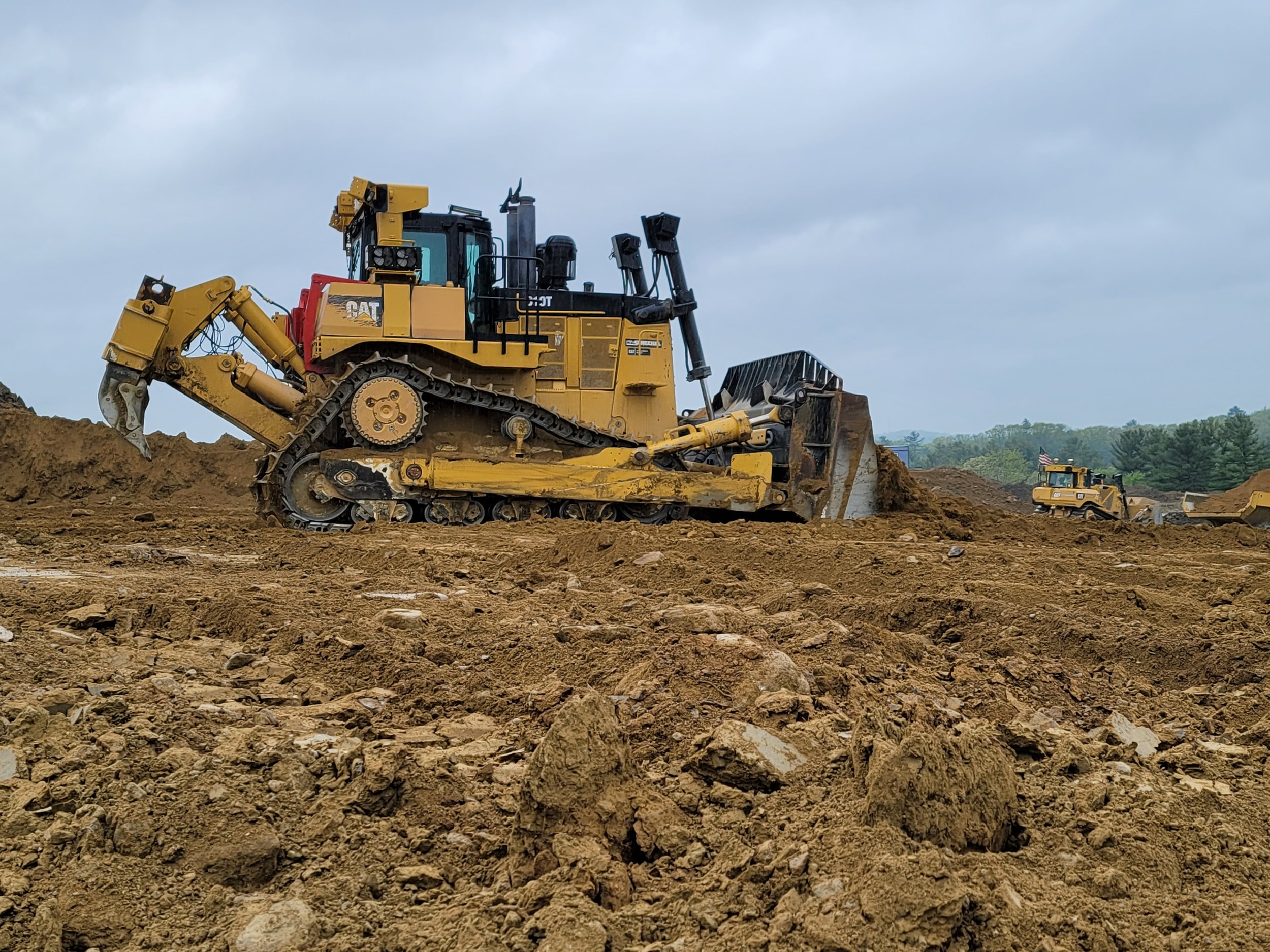
BULLDOZERS: ALL YOU SHOULD KNOW ABOUT THEM AND HOW GPS IMPROVED THEM
For GPS to work successfully and efficiently in earthwork, there must be accurate 3D models loaded into the dozer or other heavy machinery. GPS has become more of the industry standard, and we expect there will not be many site contractors running projects without GPS on their equipment. The benefits are far too great not to make the switch.
Videos

Consideration When Buying a Drone

What Happens When You Start Working with ECI

How ECI Gives Your In-house GPS a Boost

How Much Does A Road Model Cost?